Browse the Collection
Buy Now >>
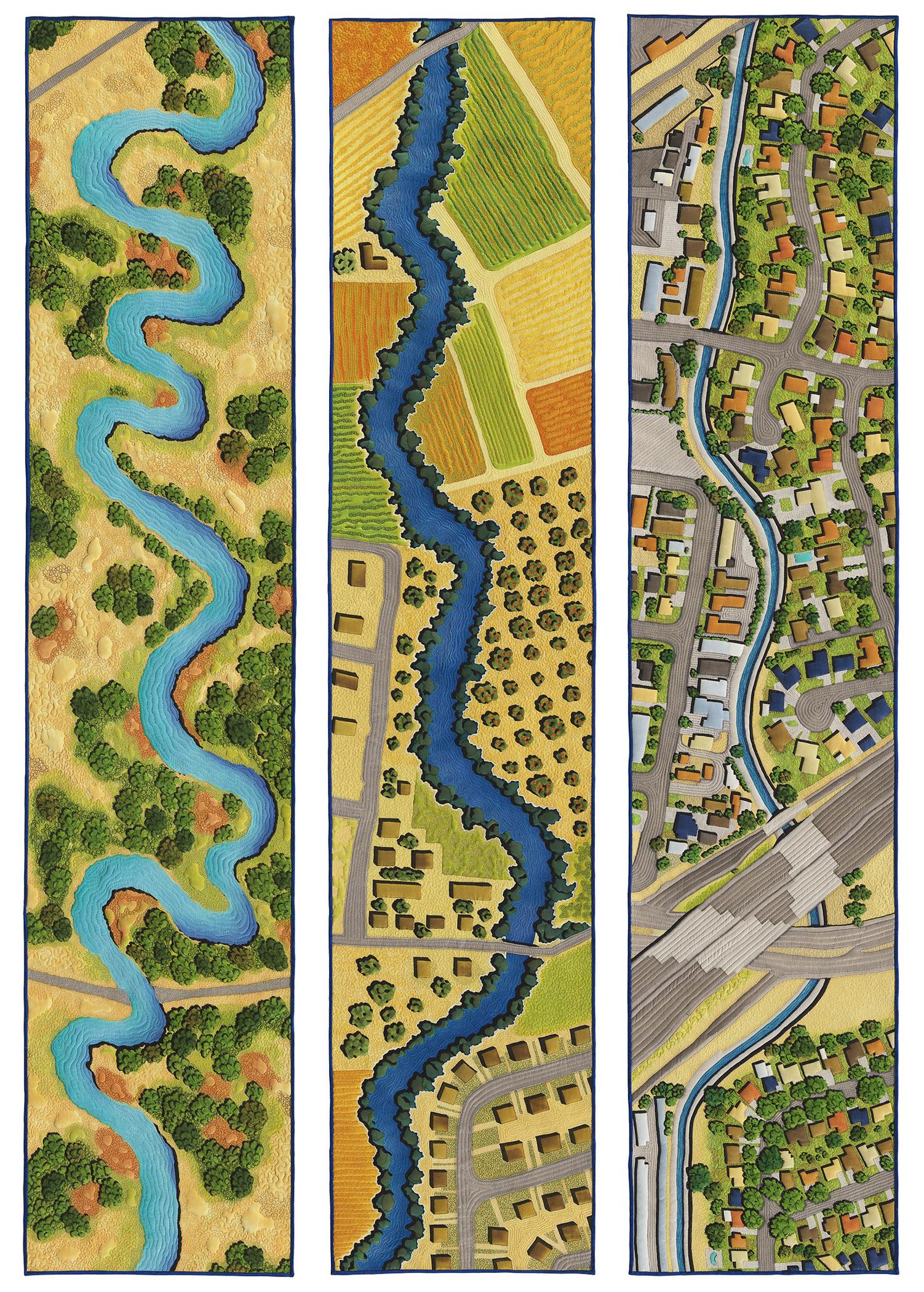
Urban Power vs. San Lorenzo Creek - What's Next?
59 in
x
48 in
(150 cm x 122 cm)
Year
2019
Photo Credit
Don Tuttle
Gallery
Price
$0.00
Based on historical maps, aerial photographs and satellite imagery, this series examines the changes to a local urban creek. Using historical ecology to recreate the visual landscape from 1873, the meandering creek is surrounded by grassland and willows. Based on aerial photographs from 1946, the next artwork shows the creek somewhat straightened to accommodate agriculture but still free flowing and able to flood; the first post-World War II suburb appears in the lower right, signaling the end of the free-flowing creek as flooding and housing are incompatible. The third artwork, based on contemporary satellite images, shows a very developed landscape and the creek encased in a narrow concrete channel. Given that our underground aquifers are recharged through gravel streambeds and we will need to rely on them more in the future of climate change, how will we redesign how we manage our urban creeks going forward?
Materials
Silk crepe de chine, silk broadcloth, silk Indian Doupioni, silk dyes, water soluble resist, polyester batting, rayon/viscose and polyester embroidery thread
Techniques
Free motion quilted

